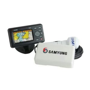
SAMYUNG N430 Wide Color GPS/Combo/Fishfinder ORIGINAL
The SAMYUNG N430 Wide Color GPS/Combo/Fishfinder
is a highly versatile and reliable device to meet navigation and fishing needs. With a wide color display, advanced GPS features and dual-frequency fishfinder, the N430 offers a complete solution for boaters and fishermen. Whether you’re navigating the high seas or searching for the perfect catch, the SAMYUNG N430 is a trusted companion for your marine adventures.
SAMYUNG N430 Wide Color GPS/Combo/Fishfinder
Compact and a simple-to-use menu structure satisfies your sail!
The SAMYUNG N430 Wide Color GPS/Combo/Fishfinder is a multifunctional device that combines GPS navigation and fishfinding capabilities into one powerful unit. Designed for marine enthusiasts and professional fishermen, the N430 offers an easy-to-use interface, high-definition color display, and advanced technology to enhance the navigation and fishing experience. In this article, we will explore the key features and benefits that make the SAMYUNG N430 a valuable addition to any boat.
Features
- Wide 4.3” High resolution TFT LCD
- Fast screen response by high performance CPU
- 10 steps adjustable LED backlight
- Multiple languages available including English, Chinese, Russian, Thai, Malay etc.
- 128MB internal memory and built-in standard Samyung chart
- DGPS (WAAS, MSAS, EGNOS)
- User-friendly operation type by using icon for each menu
- NMEA 0183 interface (AIS, NAVTEX, DSC etc.)
- 2 split screens (Chart, Data, Highway etc.)
- Suitable for small fishing boat
- Using single frequency (200Khz) for detection of small and individual fish
- Easy to use by auto gain
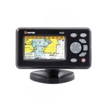 SAMYUNG N430 Wide Color GPS/Combo/Fishfinder[/caption]
Specifications
MODEL |
N430 |
| Size | 127.5 (H) x 183 (W) x 91.5 (D) mm |
| Display | Wide 4.3”, TFT color, 480 x 272 pixels |
| Supply Voltage | 10 to 36V DC |
| Supply Current | 13.8V, 0.13A min-no backlighting. 0.24A max-full backlighting. |
| Operating Temperature | -10°C to 50°C |
| Alarms | Arrival radius, anchor, XTE, danger, too shallow, too deep, fish, temperature, temperature rate, low battery, low fuel (optional), loss of DGPS fix, radar guard zone, dangerous AIS vessels. |
| Chart/User Car | C-MAP™ SD Card (NT-MAX, NT+ or NT) / SD Card |
| Waypoints | 10,000 waypoints (Event Mark: 48, Mark Color: 16) |
| Routes | 100 Routes, with up to 100 points each |
| Tracks | By time or distance, 10 tracks of 15,000 points |
| Chart Datums | 216 Chart datums (see next page) |
| Chart Scale | 0.2 to 500nm |
| Interface | NMEA 0183 |
DIMENSIONS |
183 x 91.5 x 101 mm |
STANDARD EQUIPMENT LIST |
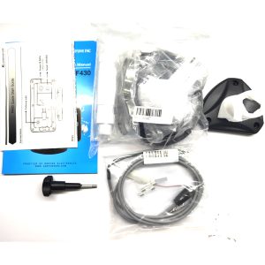
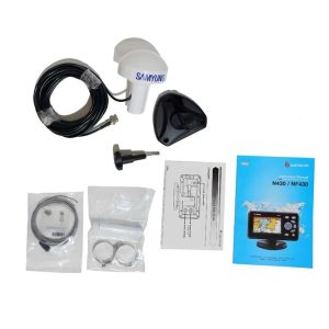
Main Unit GPS Antenna Installation Materials Spare Part Manual |
Mohon Tanyakan Stok Terlebih Dahulu Sebelum Order.


