
GPS Geodetic RTK Alpha Geo L300 GNSS
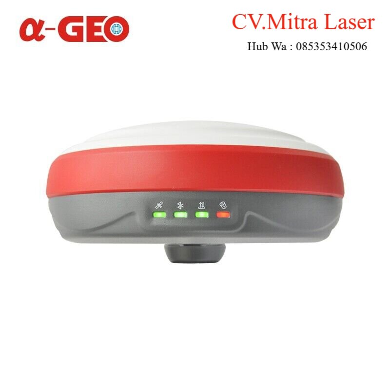
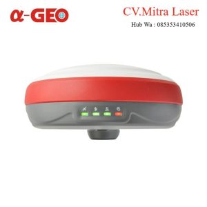
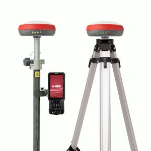
GPS Geodetic RTK Alpha Geo L300 GNSS
L300 is a compact new generation of smart GNSS receiver designed for any surveying project using the latest GNSS technology.This receiver is equipped with all modern required connectivity modules: Bluetooth, Internal radio,WIFI & 4G modem. 6800mAh Built-in battery, IMU tilt technology and WebUl are other latest technologies used in L300 receivers.
Description
L300 is a compact new generation of smart GNSS receivers designed for any surveying project using the latest GNSS technology. This receiver is equipped with all modern required connectivity modules: Bluetooth, Internal radio, WIFI & 4G modem. 6800mAh Built-in battery, IMU tilt technology and WebUl are other latest technologies used in L300 receivers.
Multi constellation
L300 with its 1408 channels new generation full GNSS chipset & ability to support multiple satellite constellations including GPS, GLONASS, BEIDOU, GALILEO, QZSS, SBAS and IRNSS provides precise and accurate spatial data for all users around the world.
WiFi and WebUl
L300 serves as a WIFI hotspot, so users can easily access, manage the status, set the configuration or download static and PPK raw data through advanced WebUl using a computer, smartphone or other electronic devices with WIFI support without any need to third-party software or cable.
IMU Tilt Sensor
L300 is equipped with a fast initialization, calibration-free & immune to magnetic interference Inertial Measurement Unit (IMU). All users can use this technology to collect or stakeout topo points up to 60°.
GSM & UHF radio
A fast internet connection is guaranteed with a built-in 4G module that accelerates receiving correction data using all telecommunication signals and bands. L300 comes with an integrated Tx/Rx internal UHF radio that ranges from 410 MHz to 470 MHz with selectable frequency providing the ability to connect and collect accurate real-time data in Base/Rover mode.
Battery & Power
L300 is delivered with an internal large capacity 6800mAh lithium-ion internal battery supporting USB type-C fast charging which allows users to work for more than 9 hours in daily fieldwork.
1P67
Choosing a small, light but professional, rugged GNSS receiver has always been a concern among professional surveyors. L300 with its high-quality magnesium alloy body provides such advantages without decreasing quality or a notable increase in price.
Working mode
Every surveyor needs operators and chooses suitable working methods based on project requirements and required accuracy. In order to work in such conditions users will need a device to be able to work in different modes such as Static, Network RTK, UHF RTK, PPK & etc. L300 is offering all you need in a package!
GPS Geodetic RTK Alpha Geo L300 GNSS
Specifications
General
Type : Land, Marine
Year of initial introduction : 2021
Height [m] : 0.15
Depth [m] : 0.071
Width [m] : 0.15
Total Weight [kg] : 1
Housing Material : ABS,aluminium alloy
Power
Internal power supply : 6800mAh battery
Operating time with internal power supply [hr] : 12
Environment
Operating temperature: min. [°C] : -40
Operating temperature: max. [°C] : 75
Humidity resistance : 100%
Water sand and dust proof : IP67
Shock and vibration proof : survive a 2m pole drop onto concrete
Performance
No. channels : 1408
Max. simultaneous tracked channels : 1408
Tracked satellite signals : GPS,GLONASS,BEIDOU,GALILEO
SBAS differential signals : WAAS,EGNOS,MSAS,GAGAN,SDCM
Reacqisition time [s] : <1s
RTK Network Compatibility : enabled
Recording
Memory medium : internal memory
Data capacity [MB] : 8GB
Type of data (on board recording) : RTCM2x,RTCM3x,CMR,CMR+,sCMRx
SPESIFIKASI Alpha GEO L300
| Performance specification | Satellite signals tracked simultaneously | GPS: L1C/A, L1C, L2P(Y), L2C, L5 |
| GLONASS: L1, L2,L3 | ||
| BEIDOU: B1l, B2l, B3l, B1C, B2a, B2b | ||
| GALILEO: E1, E5a, E5b,E6 | ||
| QZSS: L1, L2, L5, L6 | ||
| SBAS: L1, L5 | ||
| IRNSS: L5 | ||
| Channels | 1408 | |
| Cold start | <60 s | |
| Hot start | <15 s | |
| Positioning output rate | 1Hz – 20Hz | |
| Signal Reacquisition | <1s | |
| RTK Initialization time | <10s | |
| Initialization Reliability | >99.99% | |
| Time accuracy | 20 ns | |
| Positioning1 | Code differential GNSS positioning | Horizontal: 0.25 m + 1 ppm RMS |
| Vertical: 0.50 m + 1 ppm RMS | ||
| SBAS differential positioning
accuracy2 : typically <5m 3DRMS |
||
| Static GNSS surveying | Horizontal: 2.5 mm + 0.5 ppm RMS | |
| Vertical: 5 mm + 0.5 ppm RMS | ||
| Single Baseline < 30 KM | Horizontal: 8 mm + 1 ppm RMS | |
| Vertical: 15 mm + 1ppm RMS | ||
| Network RTK 3 | Horizontal: 8 mm + 0.5 ppm RMS | |
| Vertical: 15 mm + 0.5 ppm RMS | ||
| PHYSYCAL | Material | magnesium alloy |
| Dimensions | 150mm * 71mm (without bottom connector 60mm) | |
| weight | ≤1.0 Kg | |
| Operating temperature | -40°C to + 75°C | |
| Storage temperature | -55°C to + 85°C | |
| Protection IP | IP67 dust proof, protected from 30min immersion to depth of 1m | |
| Shock | survive a 2m pole drop onto concrete | |
| Vibration | MIL-STD-810G | |
| Humidity | 100%, condensing | |
| ELECTRYCAL | Power: 9~24 V DC external power input on 5 pin LEMO port | |
| Support USB Type-C fast charging | ||
| Internal 6800mA lithium-ion battery | ||
| Battery Life | Rover Mode: 12 hours | |
| Base Mode: 7 hours | ||
| Static Mode: 15 hours | ||
| Communication & Data Storage | I/O interface | LEMO port (5pin): supports power input, serial port control, and external radio communication |
| USB Type-C port: Data download / Charging | ||
| Sim card slot: supports Nano-SIM | ||
| Antenna port: UHF antenna interface | ||
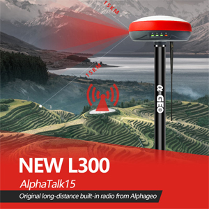
| Radio modem | Transmit power: 1/2 w switchable,Work range can reach to 15km under AlphaTalk15 protocol | |
| Frequency band: 410MHz-470MHz; supports to set the frequency | ||
| Protocols: AlphaTalk15, TrimTalk450s, SOUTH, Satel,PCC-EOT | ||
| Cellular | Integrated full frequency multi band 4G modem, supports WCDMA/CDMA2000/TDD- LTE/FDD-LTE | |
| WIFI | 802.11 b/g standard, access point & client mode, supports access to hotspot for correction transmission | |
| Bluetooth | Fully integrated Bluetooth V 4.0, range ≤ 50m | |
| Data format | RTCM2x, RTCM3x, CMR & CMR+, sCMRx, Dat, RINEX, NMEA outputs | |
| Storage | 32GB internal memory, supports cyclic storage; with ability to collect over one year raw observation based on 5 seconds interval | |
| Others | System integration | OS system: intelligent LINUX operating system |
| Tilt Compensation: IMU up to 60° (Calibration free) | ||
| Relay station: CORS relay, Radio relay | ||
| Supported controllers: all android devices with supported software | ||
| Design | button: power key | |
| Indicator: power indicator, data link indicator, satellite indicator, Bluetooth indicator | ||
| Voice: intelligent voice prompts | ||
| WEBUI: support WEBUI configuration | ||
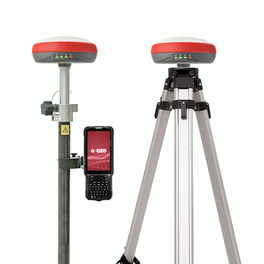
PAKET SUDAH TERMASUK:
- Controller S50III Set
- Radio External Set
- Permanent Software Supro6.0
- Carbon Pole
- 2x Tripod
- 1x Tribrach
- Adapter
Mohon Tanyakan Stok Terlebih Dahulu Sebelum Order.


